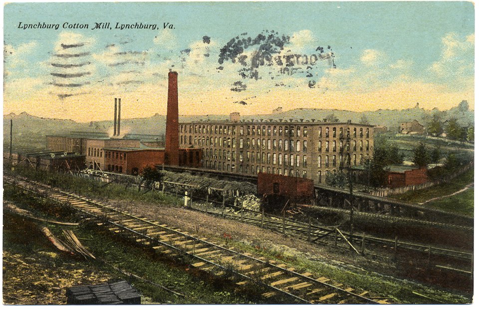
Cotton Hill, Tinbridge Hill, Chestnut Hill, Richland Hills, and Fort Hill are all well known neighborhoods in Lynchburg, and each one has its own story to tell.
Cotton Mill workers’ housing, ca. 1920s
Cotton Hill
Cotton Hill is located south of City Stadium and west of Campbell Avenue. Named for the Consolidated Textile Company (Cotton Mill) that opened in 1884 along Carroll Avenue, this company built 60 houses near the mill as housing for workers.
A progressive company for its time, the mill also provided a nursery for the workers’ children. The 1950’s were not kind to Cotton Hill as the Lynchburg Expressway cut through the neighborhood and the mill itself closed in 1957.
Tinbridge Hill
Lynchburg Hospital, built 1912 (now Tinbridge Manor)
Tinbridge Hill is bounded by Fifth and Federal Streets and Blackwater Creek. Parts of the hill were included in College and Garland Hills by early historians. There are two theories about the origin of the name. One is that it is named for the metal railroad trestle that crosses Blackwater Creek nearby, and the other is that there was a metal bridge at First and Monroe Streets that has long since vanished.
A predominantly African American neighborhood during the 20th century, the hill had the first public hospital in Lynchburg built in 1912, today an assisted living facility. Modern-day Federal Street/Hollins Mill Road was part of the Lexington-Lynchburg Turnpike in the 19th century, and Hollins Mill stood where it crossed Blackwater Creek. All that remains today is the mill dam.
E. W. Harvey’s Store, ca. 1899, corner of Fort Avenue & Wards Road
Chestnut Hill
Chestnut Hill was the name of the first home built in what is now Lynchburg in 1752. Charles Lynch, Sr.'s, home was built on a bluff overlooking the James River near today's Concord Turnpike. It was probably named for the American chestnut trees that grew in abundance in Central Virginia until a blight killed them in the early 20th century.
Today the name Chestnut Hill is linked to the western end of Fort Avenue where churches, a city street, and businesses share the name. A farm known as “Chestnut Hill” was located there in the 1930’s and 40’s, and the name came into use from the farm after it was developed.
Fort Hill
Fort Hill Woman’s Club Building within Fort Early
Fort Hill takes its name from Fort Early, a Confederate earthwork built to protect the Lynchburg-Salem Turnpike (now Fort Avenue) in 1863. The fort was the center of combat during the 1864 Battle of Lynchburg and still stands at the intersection of Memorial and Fort Avenues. It is the only remaining Civil War fort in the city.
This area was annexed into the city in 1926 and remains a largely residential neighborhood on either side of Fort Avenue west of City Stadium.
Richland Hills
Richland Hills is a neighborhood on the north side of Timberlake Road/Route 460 Business near the Expressway that was annexed into the city in 1976 from Campbell County.
Richlands, built ca. 1827
Samuel Miller owned 1,500 acres there before the Civil War, and the property was called "Richland." Miller was one of the wealthiest (and most eccentric) men in Virginia. His bequests created Miller Park, The Miller School, and Miller Home for Girls. In the 1950s, the Nelson family developed portions of the Miller land as a subdivision and named it Richland Hills.


